The plans for the partition of Polish lands by neighboring countries date back to the 14th century, when Władysław Opolczyk, the prince of Opole, led to the separation of Halych Ruthenia (Rus) from Poland in favor of Hungary.
Such an attempt was also made in the 17th century during the Polish-Swedish war by establishing the treaty in Radnot in 1656, which was to divide Poland between Sweden, Brandenburg, and the Duke of Transylvania. The treaty did not enter into force due to the start of the Danish-Swedish war.
King August II of the Saxon dynasty planned several times to give up part of the territory of the Republic of Poland to neighboring countries in exchange for help in introducing absolute rule in the rest of the country.
In the 18th century, Poland, seized by anarchy and practically deprived of armed force, was unable to resist its powerful neighbors. On April 11, 1764, Russia and Prussia signed a secret agreement in which they undertook to act against Poland in an armed manner if their interests on its territory were threatened.
In the years 1772-1795 there were three partitions and for almost 150 years Poland was subjugated by greedy partitioners.

The map of the three partitions of Poland (Source: Wikipedia)
On September 26, 1815 in Paris, the three powers Prussia, Russia and Austria signed the Holy Alliance. It was an alliance concluded after the end of the Napoleonic Wars, in which these countries undertook to apply Christian and justice (!) principles in their politics. In fact, it was all about fighting together against liberalism and revolutionary movements. There were also concerns about the Polish independence movement.
The First Partition
The first partition was carried out in 1772 and as a result Poland lost almost 30% of its lands and over 35% of its population.
- Russia seized Polish Livonia and Belarusian lands beyond the Dvina and the Dnieper, including Połock, Vitebsk, Orsha, Mohyla, Mstislav, Gomel and Daugavpils. It accounted for 96,509 km² (37,262 sq. mi.), i.e. 12.7% of the territory of Poland, inhabited by 1,310,000 people (11.5%)
- Prussia took Pomerania, the Chełmno Land, Warmia and part of Kujawy, including Chełmno, Puck, Elbląg, Malbork, Chojnice, Starogard, Inowrocław, Kruszwica, Bydgoszcza (today Bydgoszcz), Grudziądz, Tczew, but without Gdańsk and Toruń. All these territories covered 37,996 km² (14,670 sq. mi.), which constituted 5% of the territory of Poland, and the population was 580,000 (5.1%)
- Austria occupied a large part of the original Lesser Poland and Red Ruthenia up to the upper Vistula River in the north and Zbruch in the east. There are the suburbs of Krakow on the right bank of the Vistula, Wieliczka, Bochnia, Tarnów, Rzeszów, Przemyśl, Podhale, Bełz, Zamość, Lviv, Tarnopol, Trembowla, Stanisławów and Kołomyja. These lands covered an area of 89,670 km² (34,621 sq. mi.), i.e. 11.8% of the territory of Poland, inhabited by 2,130,000 people (18.6%)
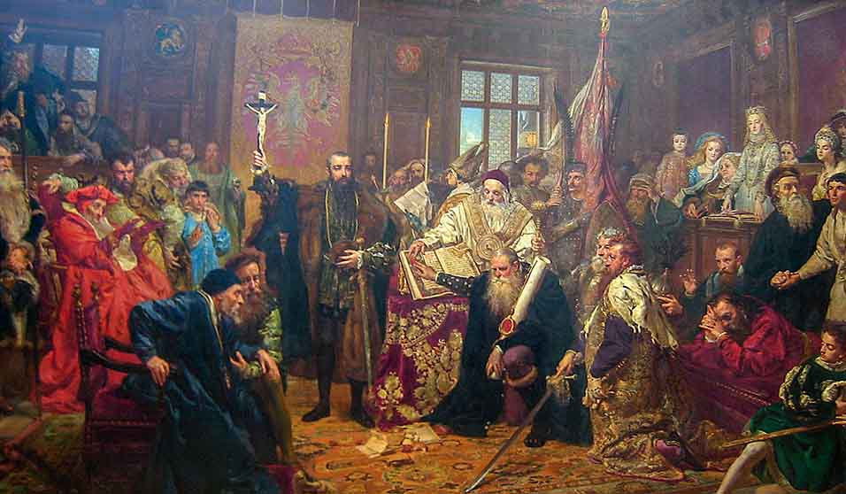
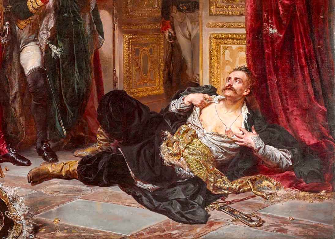
The invaders demanded that the Polish Sejm approve the partition. The assemblies were terrorized by foreign troops, mainly Russian, which focused on the most compliant deputies. It was threatened that if the Seym did not agree to the loss of these lands by Poland, the invaders would take even more. During the session at which the ratification took place, a group of patriotic MPs opposed the partition. Tadeusz Rejtan, MP from Nowogródek, protested in a particularly dramatic way. Jan Matejko commemorated this event in his masterly painting entitled "Rejtan - the fall of Poland", while Jan Kaczmarski presented it in his song "Rejtan or the Ambassador's Report".
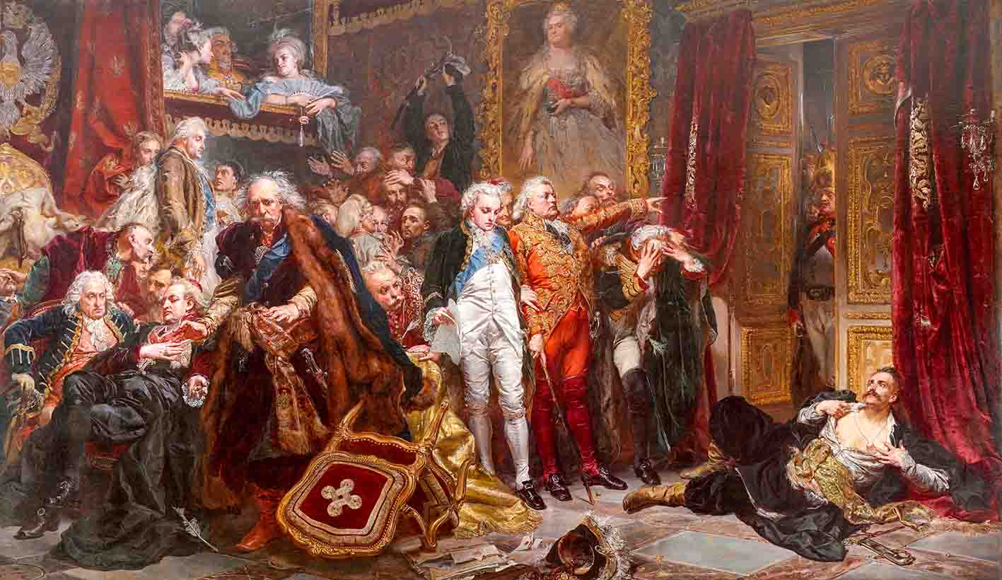
Jan Matejko, Rejtan, or the Fall of Poland, 1866, oil on canvas (Source: Wikipedia)
Unfortunately, along with ratification, the Sejm established other trade and economic agreements unfavorable for Poland.
Both the Germanic states of Prussia and Austria mutilated the Crown painfully. Poland was cut off from the sea, and the lower Vistula was in the hands of Prussia throughout its course. Gdańsk remained a Polish enclave, but without a territorial connection with the rest of the country. Austria took the salt mines, which was of great economic importance, and large areas of fertile land, especially in Red Ruthenia. Prussia took fertile lands and several important trading cities, but most of all it took over the entire overseas trade of the Crown across the Vistula River to Gdańsk. Of all the partitioning powers, Prussia achieved the greatest benefit and became a superpower from that time on.
The lands taken by the Russian partition were of relatively lower importance. Among the inhabitants there were many Belarusian and Catholic-Latvian people. There were quite large centers of Polish culture in this area, but they were not of such importance as Vilnius, Grodno, Kaunas and Brest.
Despite this painful catastrophe of territorial losses, during the 21 years of the first partition, Poland made many changes and achieved a lot. It was still a strong and viable state. A permanent government was established under the name of the Perpetual Council, headed by King Stanisław August. The council ruled the entire state apparatus, and above all, the army and the treasury. The finances have been put in order. Polish agriculture and industry developed greatly. In 1773, the National Education Commission was established, the activity of which enormously raised the level of education throughout Poland.
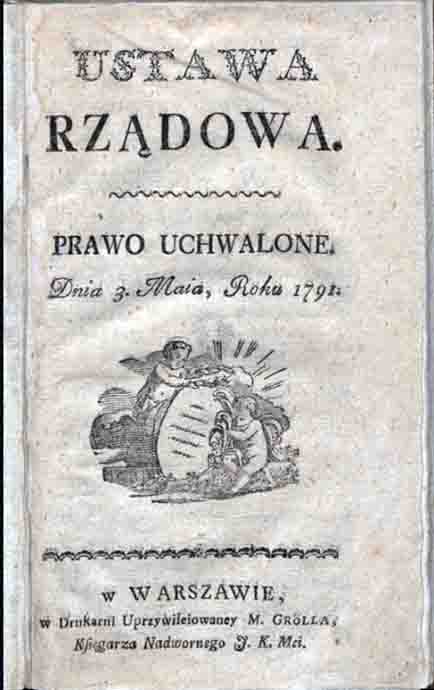
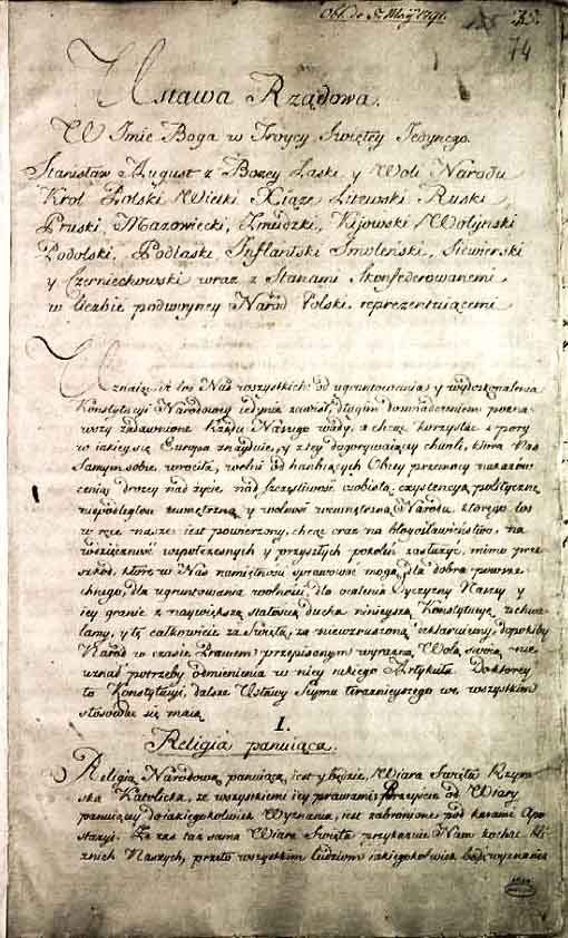
On May 3, 1791, the Constitution was established. It was a great reform of the Polish system. It introduced a hereditary monarchy, which at that time was considered a necessary step to strengthen the state. The "liberum veto" was abolished and the Seym was reformed. A joint government was established for the Crown and Lithuania, which became one state. It was the second Constitution to be written after the United States Constitution.
The Second Partition
The second partition took place in 1793 and then Poland lost almost 44% of its area and 4 million people.
Russia has decided to deal with Poland with arms in response to adopting the May 3 Constitution without its consent. The war that started on May 4, 1792 (on the first anniversary of the Constitution) ended in the defeat of Poland after two months. King Stanisław Poniatowski, at the request of Tsarina Catherine II, stopped fighting and joined the Targowica Confederation, favoring the interests of Russia. On January 23, 1793, Russia and Prussia signed a new partition treaty. The objections of the members of the Patriotic Party did not help.
This time, the two powers, Russia and Prussia, additionally seized the following lands:
- Russia seized 250,000 km² (96,525 sq. mi.), which included a huge area of Ukraine and a large part of Belarus, Polesie, Volyn and Podolia. Żytomierz, Uman, Winnica, Berdyczów, Bar, Bracław, Kaniów, Kamieniec Podolski, Pińsk, Mozyrz, Słuck, Minsk, Bobrujsk, Borysów and Dzisna were seized. It was inhabited by 3 million people.
- Prussia occupied an area of 58,300 km² (22,509 sq. mi.), including Gdańsk, Toruń, Poznań, Gniezno, Kalisz, Częstochowa, Piotrków, Łęczyca, Sieradz, Płock, Sochaczew, Łowicz and Rawa Mazowiecka. The population there was about 1 million.
The partition was approved by a "silent" session of the Grodno Sejm.
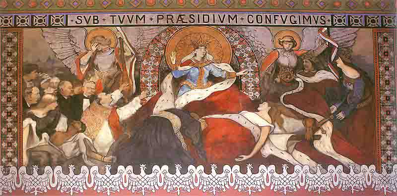
Allegory of a Dead Poland, Włodzimierz Tetmajer, 1895, painting in the Cathedral of St. Nicholas the Bishop in Kalisz (Source: Wikipedia)
After the second partition of Poland, only a truncated territorial hull remained, which included Warsaw, Krakow (without the suburbs beyond the Vistula), Vilnius, Grodno, Kaunas, Brest, Lutsk, Lublin, Sandomierz, Kielce and Kurland. It was also ordered that the Polish army would be reduced to 15,000. This corpse of the state lasted two years.
The Third Partition
On January 3, 1795, the third partition of Poland took place, after the fall of the Kościuszko Uprising, in which Poles protested against the oppression by the invaders. The third partition led to the complete plunder of the remaining Polish land and the Commonwealth disappeared from the map of the world. The three powers divided the rest of Poland again.
- Russia seized Vilnius, Kaunas, Grodno, Nowogródek, Brest-Litovsk, Lutsk, Kremenets and Kurland. In this way, an area of 120 thousand sq. km (46 thousand sq. mi.) joined the previously seized Polish lands together with 1.2 million people living there.
- Prussia took Warsaw, Białystok, Łomża, Ostrołęka, Suwałki, and the left-bank suburbs of Grodno and Kaunas. This time they seized an additional 55 thousand km square (21,236 sq. mi.) and about 1 million Poles.
- Austria seized Kraków, Kielce, Radom, Sandomierz, Lublin and Siedlce. To the previously plundered lands, it added 47,000 km square (18,147 sq. mi.) and 1.2 million inhabitants.
Summary of the Partitions
In this way, the entire Crown, with the exception of Ukraine, Volhynia and part of Podolia, fell into German hands. Lithuania was divided between Russia and Prussia, with Russia taking most of it.
At the time of signing the St. Petersburg Convention in 1797, the three powers undertook never again to use the name "Kingdom of Poland".
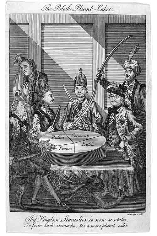
A satirical print depicting Poland as a "plumb cake" being divided into four (!) pieces — an etching by John Lodge for Westminster Magazine, August 1774, from the collections of the British Museum (Source: Wikipedia)
As a result of three partitions, states hostile to Poland seized:
- Russia: 466,509 km² (180,120 sq. mi.) and 5.5 million residents
- Prussia: 151,296 km² (58,416 sq. mi.) and approx. 2.6 million inhabitants
- Austria: 136,670 km² (52,769 sq. mi.) and around 3.3 million people
After the third partition, the area of the seized Polish lands constituted more than half of the territory of Prussia, while Poles constituted almost half of its population. Since then, for 123 years, until 1918, Poland did not exist as a sovereign state.
The Triangle of the Three Emperors, or rather the Three Emperors' Angle (German: Drei Kaiser Ecke, Russian: Угол Трёх Императоров) is the place where the borders of the three European powers that took part in the partitions of the Polish-Lithuanian Commonwealth met in 1846-1915. Today it is a place near the cities of Mysłowice and Sosnowiec. Until the end of World War I, it was an important tourist destination, visited by 3-8 thousand tourists a week.
Poland has not perished yet...
Poles have never come to terms with slavery and did not consider themselves a subordinate nation. The intensified Germanization and Russification of the Polish nation failed. Poland rose up in arms against the foreign invaders, sacrificing the lives of its own people. Subsequent uprisings — the Kościuszko Uprising started on March 24, 1794, the November Uprising of November 29, 1830, the Krakow Uprising of February 20, 1846, and the January Uprising of January 22, 1863 — were heroic uprisings of the enslaved nation.
The outside world was silent and only a few voices spoke out in defense of Poland. Spain opposed the first partition of Poland and King Charles III offered military help, but France opposed it. The "enlightenment" camp in Europe fervently supported the Partition. The French writer Voltaire in a letter to Frederick the Great wrote: "Most Holy Lord, they say that it was you who devised the partition of Poland: I believe it, because a genius is revealed in it."
The only country that never recognized the partitions of Poland was the Ottoman Empire (Turkey). At each presentation of the ambassadors at the Sultan's court until 1918, it was announced that "the envoy from Lechistan had not yet arrived".
Before the partitions, the area of Poland was 754,475 km² (291,304 sq. mi.). After WWI, as a result of the Polish-Russian wars and the seizure of Zaolzie by Poland in 1938 (about 900 km², or 347 sq. mi.), the area of the country reached 389,700 km² (150,464 sq. mi.) and that was its size on the eve of the Second World War. At present, the area of Poland, once again truncated after WWII, is only 312,696 km² (120,733 sq. mi.).
And yet, gaining freedom by Poland in 1918 was an event of great importance. Our country became independent, with its own government, with its own borders and where it was allowed to speak Polish again.
November 11 is solemnly celebrated all over Poland. The annual Independence March, in which thousands of Polish patriots pass through the streets of Warsaw, is a message to the world that Poland exists. Let us defend our independence and the celebration of this holy day.
Translated from Polish by Andrew Woźniewicz.


